Scenic spots
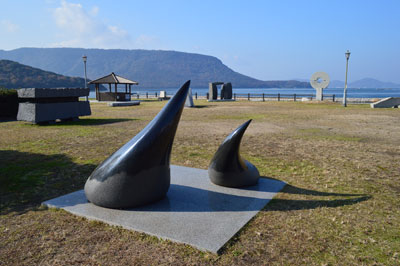
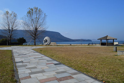
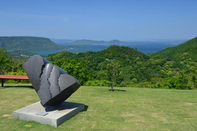
Shirobana Park
The park is located on the west coast of town. Visitors can enjoy the view of small islands, Yashima peninsula and the good harmony with the blue sky and the inland sea. They can also enjoy stone sculptures, made by sculptors from both inside and outside the country, that are displayed there.
Information of the lookout <<< CLICK HERE
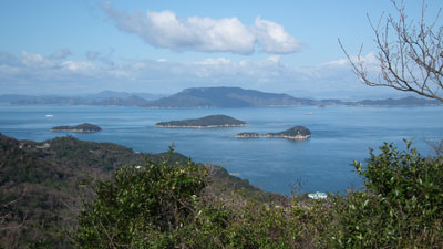
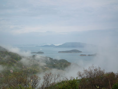
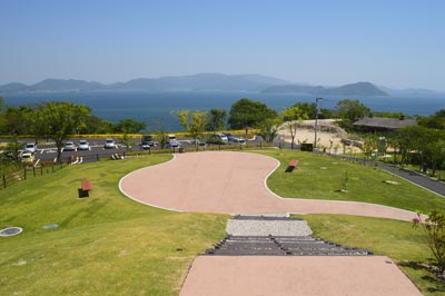
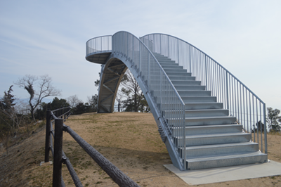
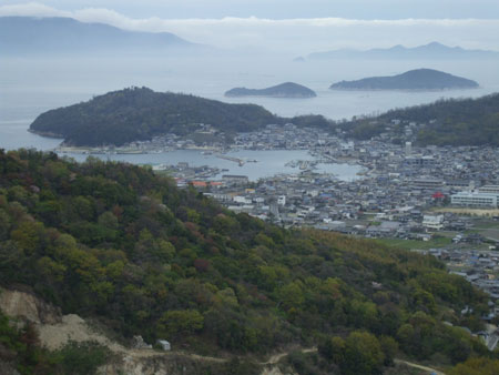
Aji-Ryuouzan Park
Ryuouzan is a mountain located on the east side of town. Ryuou, the Dragon King, is the god of rain. Ancient people enshrined the god at the top of this mountain and prayed for constant rainfall. Even now, some devotees maintain that small shrine and its customs. A new park was developed on the northern ridge of the mountain in 2016. People can enjoy the spectacular panoramic view of the inland sea from its observatory. It also offers the beauty of stone sculptures which has been arranged in the park.
The view of each direction can be seen from the links below.
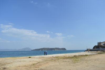
Goten Kaigan
Goten means palace. Kaigan is beach in Japanese. In 1688, Yorishige Matsudaira, who was the feudal lord of the Takamatsu clan, built a villa and used to stay there for several months a year. The tide changes rapidly along the beach. Lots of anglers also enjoy their times at the shore.
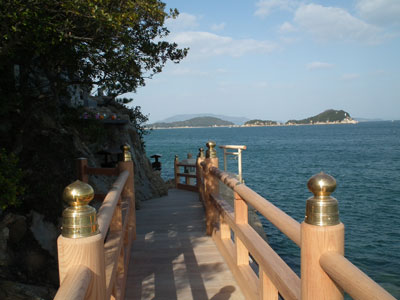
Takei kannon
Kannon is a bodhisattva who listens to people’s complaints and helps them mercifully. Here in Aji Town, it’s enshrined in a cave near Takei Sandy Beach, which is the northernmost point of Shikoku. It also had a role as a protective deity for Takamatsu Castle in the Edo era. Sea water sometimes comes up to the approach of the temple. The sand of the beach is coarse weathered granite.
Kamano Area
This area was a port of call on trips from Osaka to Shikoku or Kyushu in the Edo era. Visitors can see Awajishima Island from here, if the weather permits. Shodoshima Island is located a short distance away. Kamano Port is popular among anglers. They enjoy fishing there all year long. People also enjoy bathing at the beach near the port in summer.
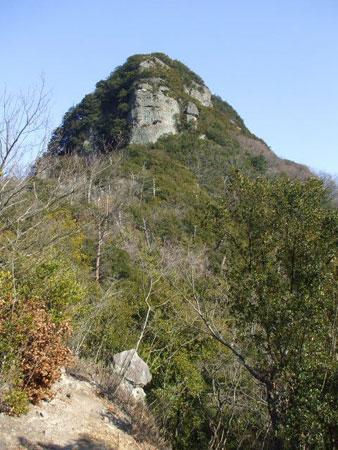
Mt.Goken and Kojiri Pass
Mt. Goken has five peaks. Volcanic tuff is arranged on the sandstones at Mt. Goken, so it’s been weathered into fantastic forms. The road from Mt. Goken to Kojiri Pass has great scenery. It can be described as a corridor to heaven.
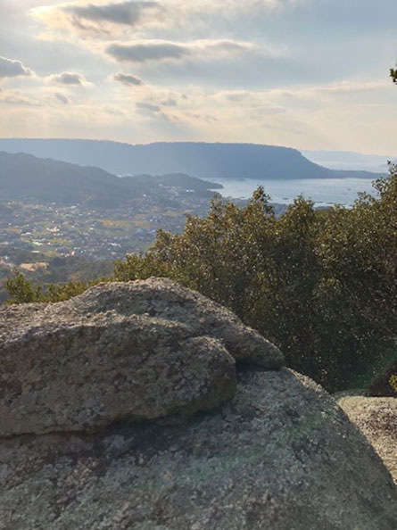
Tohmiyama
The literal meaning of ‘Tohmiyama’ is the mountain from where we can look around to the distance. Please go up north the forest road for about 300 meters from the junction of three roads, where the gate for Ryuousan-park locates. There is a trail leading to the top of the mountain.
The length of the trail is only 400 meters. There are a lot of ubame oak, Quercus phillyraeoides, along that. And, some wonderful views can be seen at some clear spaces on the way to the top of the mountain. Also, huge core stones of granite are situated here and there on the mountain. People enjoy rock climbing or bouldering thereat on holidays.
The height of the peak is only 235 meters. But, there is a ruin of lighting the signal fire. It had been availed since A.D. 600s, the Asuka era. At the place, you’ll be rewarded with panoramic views of Bisan-seto area’s blue water and various islands.
The center of the town & some islands